


Creating Custom Maps with Linky Map

There’s no better way to drive a point home than with visualizations. The expressive power of visualizations ensures that your users understand what you’re trying to say in an interactive way, and Linky Map has now been updated to allow you to convey your message with custom maps on your Joomla! website.
The new update to Linky Map allows you to create your own maps, and illustrate and annotate them in various ways. Moreover, the process takes minutes, and maps retain all functionality, including zooming capabilities. These maps can then be embedded as modules in pages or in articles.
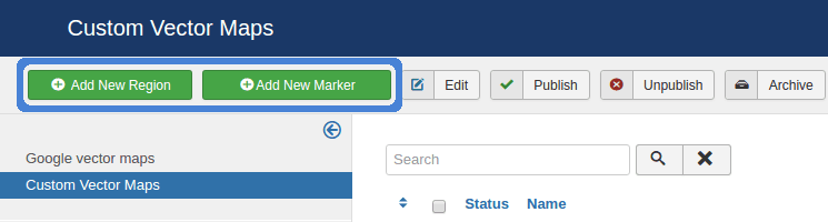
There are two principle ways of creating these custom maps - region maps and marker maps - both of which can be accessed from the custom vector maps menu item in the Linky Map component. The first one allows you to highlight locations in a region map, whereas the alternative allows you to place markers in particular places. From this page, you can also modify, publish or remove existing maps.
Custom Region Maps
To create a custom, highlighted region map, click on the add new region button. Before starting to color in the map, assign the map a name, and an optional alias. From this page, you can also edit different map attributes and styling options, such as borders and dimensions, ensuring that the map fits in perfectly with your Joomla! website’s theme.
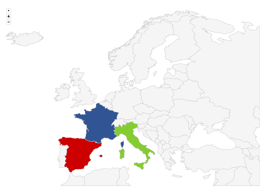
The whole point of region maps is highlighting regions in a map by using a color-coding schemes. There are 16 different regions you can use, ranging from the whole world to smaller regions, such as France. Once you select a region, you can start coloring in your map.
Each region can be assigned a title, a description, and a color that can be used to highlight differences between regions. Titles and descriptions serve to explain the significance of each region, and are visible to users when they hover over locations.
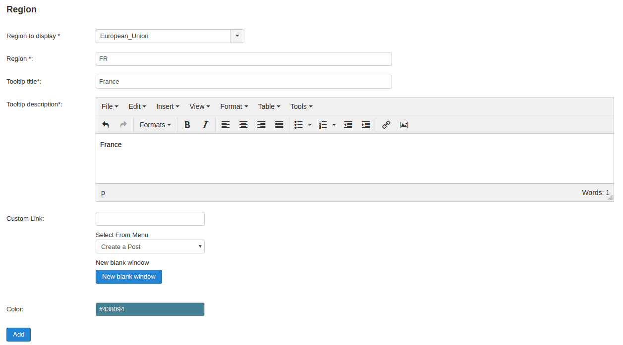
Regions are identified uniquely via their ISO codes - for example, France’s ISO code is FR. If you don’t know ISO codes by heart, then fear not - simply start typing regions, and Linky Map will translate that into an ISO code automatically. Once you’re done adding regions, save the map in order to be able to use it on your Joomla! website.
Custom Marker Maps
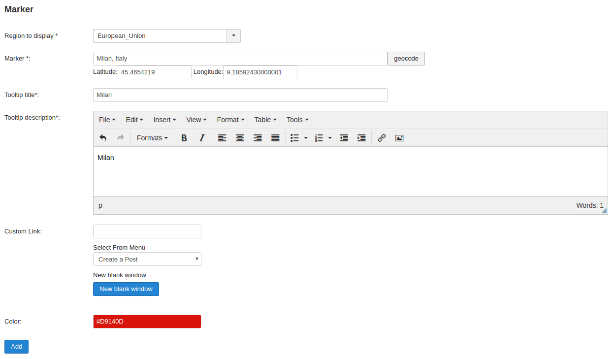
Marker maps work very similarly to region maps. The chief difference is that instead of coloring in regions on a map, circular markers are placed on points of interest. The starting point is the add new marker button in the Linky Map page.
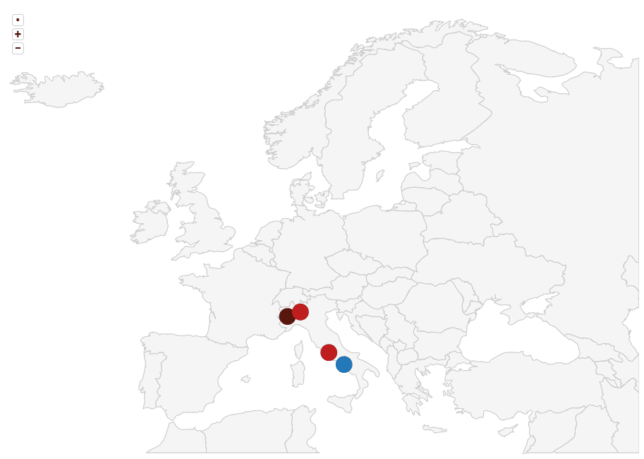
Like with region maps, the first step is defining a map name and an alias, and tweaking its attributes. The main difference comes next - instead of picking regions, locations identified by geocodes are used to place markers. What’s more, you don’t have to look up the geocodes of locations either!
Choosing a location has been greatly facilitated - not dissimilar to picking a region for your map. One you start typing, suggestions will appear, and Linky Map automatically converts locations to geocodes. Once you’re ready, just save changes and your maps are ready to be embedded!
You might be a travel blogger, an independent journalist, or simply a soul with a penchant for geography. Whatever the case may be, Linky Map for Joomla! allows you to bridge the gap between words and places and can be used with our maps extension which is compatible with the biggest Ecommerce solutions for Joomla.
When you subscribe to the blog, we will send you an e-mail when there are new updates on the site so you wouldn't miss them.

Comments